Naturgy _ Work Monitoring Mock-Up. JUL-DEC. Area 002 (1)")
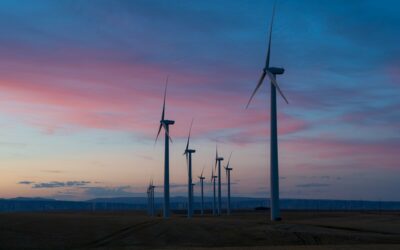
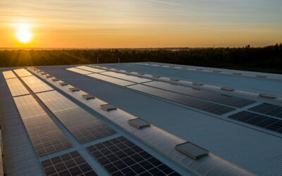
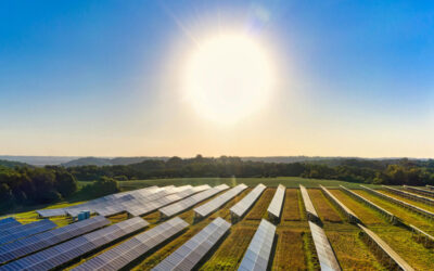
Site selection is a critical phase in the development of renewable energy projects. To make a sound decision, it’s not only necessary to consider technical and economic feasibility, but also the degree of environmental impact of the project.
The Environmental Impact Assessment (EIA) is, therefore, the central axis of this phase, and satellite data has become an indispensable tool to carry it out efficiently and rigorously.
In this article, we will delve into how these data allow for the acceleration of environmental impact studies, strengthening the reliability of diagnoses and advancing towards a more agile execution of energy projects.
Key environmental factors for choosing land to develop a renewable energy project
One of the first questions to answer when considering site selection for an energy project is: what is the potential environmental impact of building and operating a plant on a specific piece of land? The EIA must identify, from the earliest stages:
- Areas of high ecological value: areas with the presence of protected species, fragile ecosystems (wetlands, native forests), biological corridors, etc. The objective is to avoid these areas or, in exceptional and justified cases, to design extremely rigorous mitigation measures.
- Environmental hazards: areas prone to flooding, landslides, accelerated erosion, forest fires, etc. These hazards not only threaten the project’s infrastructure, but can also exacerbate pre-existing environmental impacts.
- Potential conflicts with land use: compatibility with agricultural activities, urban areas, areas of cultural or archaeological interest. The EIA must analyze how the project interacts with the social environment and minimize potential conflicts.
- Regulatory compliance: all regulations must be considered, such as the European Union Deforestation Regulation (EUDR).
What advantages do satellite data offer in the study of land from an environmental perspective?
Satellite data offer a series of crucial advantages in the analysis and land selection phase, specifically for the EIA:
Holistic vision over time
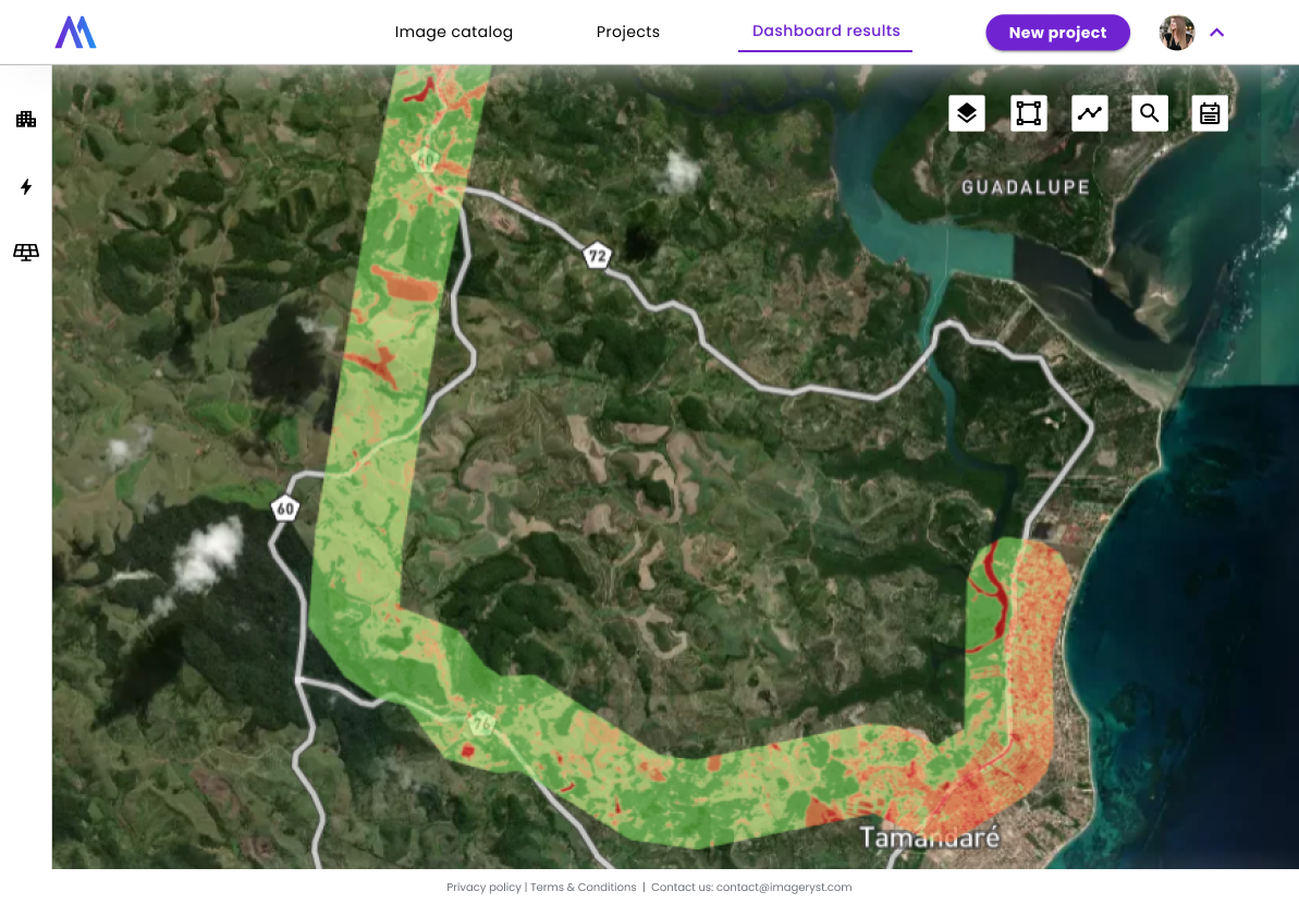
They allow the evaluation of large areas of land remotely, identifying key landscape features (vegetation, hydrology, topography) and detecting changes over time. This ability to «see the before and after» is essential to:
- Identify pre-existing degradation processes (deforestation, erosion): satellite data reveal the past of the land, showing previously degraded areas. This avoids attributing previous impacts to the project and allows mitigation to be focused.
- Establish a solid environmental baseline: remote sensing offers an initial «photograph» of the land, an essential reference point. This allows future changes to be measured accurately and the real impact of the project to be evaluated.
- Foresee possible cumulative impacts: combining historical and project data, areas where new impacts would add to existing problems are identified. This anticipation allows negative synergistic effects to be prevented.
Early detection of critical areas
Allows precise identification of:
- Detailed vegetation cover: classification of vegetation types, detection of indicator species, assessment of vegetation health.
- Water bodies and wetlands: precise delimitation, identification of changes in water quality (sedimentation, eutrophication).
- Hazard zones: identification of areas susceptible to landslides, floods, etc., through the analysis of digital elevation models and historical data.
Optimization of field studies
Satellite data allow:
- Focusing efforts: directing flora, fauna, and water quality sampling to areas identified as critical.
- Reducing costs and time: minimizing unnecessary travel and optimizing the logistics of field teams.
Regulatory compliance and transparency
- Continuous monitoring: satellite data allow constant monitoring of the state of the land, crucial for verifying compliance with the mitigation and compensation measures established in the EIA.
- Objective evidence: satellite images are irrefutable proof of the evolution of the environment, facilitating accountability to authorities, investors, and the community.
Informed decision making
The selection of land for a renewable energy project can no longer depend on intuition or superficial evaluations. Environmental and regulatory complexity requires a solid foundation of objective and up-to-date data. Satellite data provide that foundation:
- Minimization of uncertainty: investors seek projects with controlled and well-understood risks. Satellite data drastically reduce uncertainty, facilitating decision-making and attracting capital.
- Adaptability and resilience: a site could present problems in the future due to climate change, urban expansion, or other factors. Continuous satellite monitoring allows these changes to be anticipated and the project to be adapted.
- Design optimization: with detailed information on topography, vegetation, and other factors, the project design (location of turbines, panels, substations) can be optimized to minimize environmental impact from the outset.
Improved reputation
Demonstrating a genuine commitment to environmental protection, from the initial phase of site selection, generates tangible benefits:
- «Social license» to operate: opposition from local communities can stop a project. The transparency and environmental commitment demonstrated through satellite data help build trusting relationships with communities.
- Attraction of «green» investments: satellite data provide verifiable evidence of environmental commitment, attracting socially responsible investors and improving access to financing.
- Competitive advantage: companies that can demonstrate a lower environmental impact and a greater commitment to environmental protection have a significant competitive advantage.
Transparency
Transparency is essential to building trust with all stakeholders: authorities, investors, local communities, and society in general. Satellite data offer an unprecedented level of transparency:
- Clear and effective communication: satellite images are easy to understand, even for people without technical knowledge, and allow the impact of the project to be visualized in a much clearer way than traditional technical reports.
- Companies can use satellite data to proactively demonstrate that they are complying with their environmental commitments. This strengthens the relationship with regulatory authorities and reduces the risk of sanctions.
- Transparency facilitates constructive dialogue with stakeholders. By having access to the same information, all parties can participate in an informed debate and seek joint solutions to potential problems.
Regulatory Compliance and the EU Deforestation Regulation (EUDR)
In recent years, environmental regulations have become more relevant worldwide. One of the best examples is the European Union Deforestation Regulation (EUDR), which requires companies to demonstrate that their operations do not contribute to deforestation and that they maintain sustainable practices. Non-compliance can lead to heavy financial penalties and reputational damage.
Satellite imagery has proven to be one of the most effective tools for:
- Detecting and quantifying forest loss: pattern recognition algorithms allow deforestation to be identified even when it covers small areas of land.
- Issuing early warnings: in case of detecting possible irregular activity, the alerts allow prompt intervention and corrective measures to be taken before the problem worsens.
- Generating automated compliance reports: this visual evidence of change in vegetation cover over time greatly facilitates the work of audit teams and the certification process.
For energy projects that require earthmoving or changes in land use, being able to demonstrate constant monitoring and control of reforested or restored areas can be key.
In addition, continuous compliance with environmental regulations brings multiple benefits: reduction of legal risks, improvement of corporate reputation, and clear documentation for auditors.
The Imageryst approach: reliable data and ease of use
At Imageryst, we specialize in the remote analysis and monitoring of energy assets, including their environmental impact. We offer:
- High-resolution and frequently updated data, allowing for continuous monitoring.
- Ability to compare images over time, helping to identify subtle changes in vegetation cover or soil quality.
- Integration with existing GIS systems, so that any department, without advanced technical skills, can benefit from satellite information.
- Automation of reports that highlight early warnings about deforestation, erosion, or excessive vegetation growth that could interfere with critical infrastructure.
In view of the increasingly ambitious climate goals, satellite technology is consolidated as an essential pillar to ensure that energy development is truly sustainable.
With solutions like those offered by Imageryst, companies can accelerate their environmental impact assessments, improve the transparency of their decisions, and move forward with solidity in building a future in which clean energy is the protagonist, without compromising the balance of the planet.
If your organization is evaluating the implementation of energy projects and needs a reliable system to control the environmental impact, satellite images could make a difference.
Are you interested in learning more about this topic? We encourage you to attend this webinar where we will discuss the value of satellite data to optimize the choice of location for renewable energy plants. A decision where environmental impact assessment is key. We look forward to seeing you there!