Naturgy _ Work Monitoring Mock-Up. JUL-DEC. Area 002 (1)")
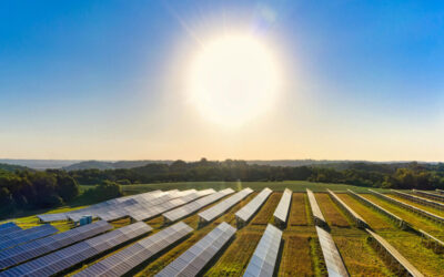
Choosing the right location for solar parks is one of the most strategic decisions in any solar energy project. The site directly affects plant efficiency, implementation cost, required permits, and long-term viability.
That’s why, at Imageryst, we’ve developed a methodology based on spatial data analysis and satellite imagery that enables more informed decisions from day zero.
Here are 10 key factors to consider when selecting the ideal site for your solar plant:
Keys to choosing the best location for solar parks
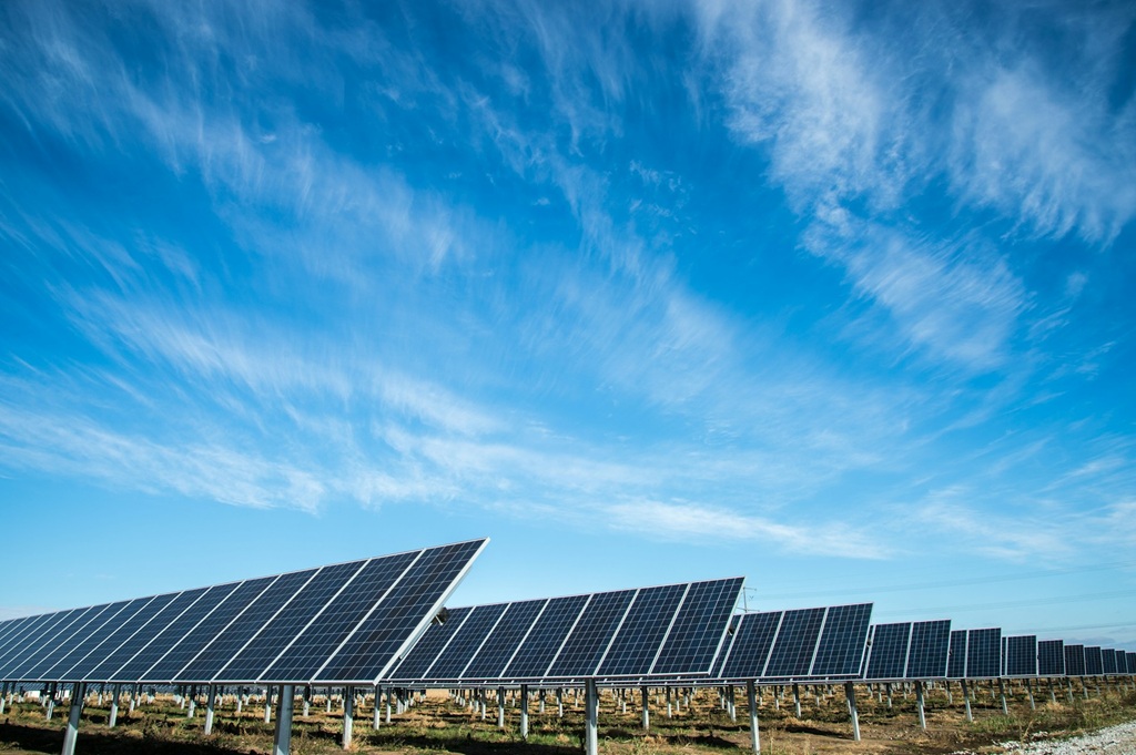
1. Solar radiation and terrain orientation
The first requirement for any solar park is that the land receives high solar radiation for most of the year. Spatial analysis tools make it possible to visualize global and seasonal irradiance maps to filter areas with the greatest solar potential. It’s not just about the amount of sun: the terrain’s slope and orientation are also crucial to maximize panel performance without resorting to complex or costly structures.
2. Topography and slope
Steep slopes can drive up project costs due to earthworks, special foundations, and constraints on heavy machinery access. A detailed topographic analysis should measure slope in both the north–south and east–west directions and estimate the costs associated with grading the land.
3. Access to electrical infrastructure
One of the most critical variables for financial feasibility is proximity to existing electrical infrastructure. The closer the park is to a high-voltage line, the lower the interconnection costs and the higher the assurance of energy evacuation. In many cases, sharing existing substations or lines can accelerate commissioning and reduce upfront investment.
4. Environmental regulation and permits
Building a solar plant requires strict compliance with local environmental regulations. This includes environmental impact assessments, land-use restrictions, protected areas, dust and noise emissions, and waste management. A preliminary legal review supported by georeferenced information helps anticipate potential roadblocks and plan realistic permitting timelines.
5. Presence of water bodies and flood-prone areas
Geospatial data is essential for identifying streams, rivers, and flood-prone areas that could endanger equipment or limit access during certain seasons. At the same time, nearby water sources can facilitate regular panel cleaning, improving long-term efficiency.
6. Soil conditions and prior land use
Soil type directly affects the foundation design. Clay-rich or very sandy soils may require more expensive works. Understanding prior land use (agricultural, industrial, forest) helps detect potential legal restrictions, environmental liabilities, or even opportunities to reuse existing infrastructure.
7. Proximity to other plants or energy parks
The presence of other solar plants or wind farms nearby can be a benefit or a drawback. On the one hand, they can enable infrastructure synergies. On the other, they may create competition for grid evacuation capacity or technical interferences (in the case of wind turbines). A solid analysis of the competitive and energy environment is essential to anticipate these scenarios.
8. Cadastral restrictions and easements
It’s vital to cross-check the actual property boundaries with cadastral records and determine whether there are easements (electrical, hydraulic, railway) that may limit land use. Errors at this stage can lead to legal disputes, penalties, or even partial dismantling of the installation.
9. Vegetation, shading, and protected species
Excessive vegetation not only creates shade that reduces energy production but can also pose a fire risk if not properly managed. The presence of protected species requires specific studies and special permits for any habitat alteration. Satellite analysis helps detect these areas and adapt the park design to regulations without compromising efficiency.
10. Accessibility and construction logistics
Last but not least is site access logistics. Reliable roads in good condition are essential to transport solar panels, cranes, and other heavy equipment to the site. The cost of upgrading access roads is often higher than expected if not previously assessed using accurate elevation and traffic data.
How can Imageryst help?
At Imageryst, we’ve developed a platform based on satellite imagery and spatial analysis that evaluates all these factors in a centralized and objective way. Our technology helps you:
- Identify the best sites to develop a solar plant using technical, economic, and legal criteria.
- Compare multiple locations quickly, reducing weeks of work to hours.
- Generate automated reports to support decision-making by investors, engineering firms, or public administrations.
- Monitor project progress during construction and operation with frequently updated high-resolution imagery.
Site selection for a solar park isn’t just about “where the sun is.” It’s a complex decision involving multiple technical, logistical, environmental, and legal factors.
Thanks to spatial data and new georeferenced analysis technologies, it’s now possible to make that decision far more precisely, quickly, and cost-effectively.
At Imageryst, we’re ready to help your next solar project reach its full potential from the very first square kilometer.
Want to dive deeper into these factors? You can download this free checklist and also watch this on-demand webinar.
If you have questions, feel free to contact us and discover how we can help you turn satellite data into strategic decisions.