

Analyze and monitor your assets from above
A 360º platform for the planning and execution of energy projects remotely.


")
Advantages
All the advantages of our tool
Unlock the power that our solutions offer to transform your business.

For all users: No more technical barriers
Our easy-to-use interface lets anyone access and use our solutions without needing technical skills.

Cross-functional platform for all departments
Imageryst works seamlessly across all departments, enhancing collaboration and streamlining workflows.

Scalable and global SaaS platform
Our solutions grow with your business and are accessible from anywhere worldwide.
Remote Control, Local Results: Asset Monitoring Solutions
From perfect spot selection to construction progress monitoring, control your assets using precise satellite data. Grounds, buildings, roads, and much more!
Reliable and accurate datasets
Access high-quality data you can trust, ensuring precise monitoring and informed decision-making for your projects.
Frequent, updated and comparable information
Receive regular updates and compare data over time, allowing you to track progress, identify trends, and make timely adjustments.
Changes alerts and Up-to-date reports
Stay informed with alerts on any significant changes, and access detailed, up-to-date reports to keep your projects on track.
Global coverage + Historical data
Monitor assets worldwide and analyze historical data to gain a deeper understanding of changes and patterns over time.
Before
Traveling to sites
Static and outdated data sources
Manual, depending on specialized teams and consultants
Geographical limitations
Reactive work
Working from the office & prioritization system for visits
Evolving detailed information (with comparisons)
Improved response times – anticipate problems
With Imageryst
Before
With Imageryst
Traveling to sites
Working from the office & prioritization system for visits
Static and outdated data sources
Evolving detailed information (with comparisons)
Manual, depending on specialized teams and consultants
Geographical limitations
Reactive work
Improved response times – anticipate problems
Request a demo
Reduce CO2 emissions by minimizing travel with Imageryst.
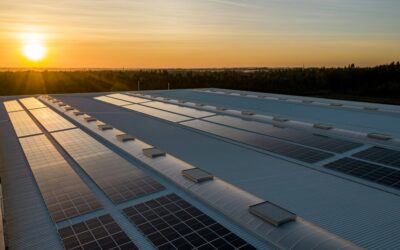
Site Analysis
Select the Ideal Land for Energy Projects
Tailored remote solutions to optimize renewable energy projects. From site selection to remote monitoring, our platform offers real-time insights that streamline operations and maximize efficiency throughout the project lifecycle.

Usable area

Panels Built
Panels Built
Work Progress
Track Construction Progress at Every Phase of the Project
Stay informed on the status of construction projects from start to finish. Monitor each phase remotely to ensure timelines are met, detect issues early, and minimize delays. Our data-driven insights allow for real-time progress tracking, making it easier to manage large-scale construction without needing constant on-site supervision.
Maintenance
Supervise the Condition of Assets and Optimize Their Maintenance
Ensure your assets are in optimal condition by leveraging continuous, data-driven maintenance monitoring. Our platform helps you prevent failures, schedule proactive maintenance, and extend the life of your assets—all while reducing operational costs. Supervise the maintenance of solar panels, power lines, and other critical infrastructure with up-to-date, actionable insights.

Risk zones

%
Vegetation
Environmental Impact
Control and Reduce the Impact of Your Projects
Manage and minimize the environmental impact of your projects with comprehensive insights. From monitoring vegetation health to controlling emissions, our solutions help you assess and mitigate the impact on natural resources. Plan reforestation efforts, understand environmental vulnerabilities, and take action to create a more sustainable future.
Access
How you can use Imageryst
Discover how to unleash the full potential of Imageryst according to your needs. We provide the tools to improve your data analysis and integration.

Already have a GIS software
Easily integrate our satellite data into your GIS software.

Access to an easy-to-use interface
Use our Web App
Quickly access and analyze your assets from anywhere with our intuitive app.
Supported by
Our trusted partners and supporters
We’re working with the best!


Updates
Check our latest blog posts
Keep informed with the latest insights and updates from Imageryst. Explore our recent blog posts to discover new trends and developments.
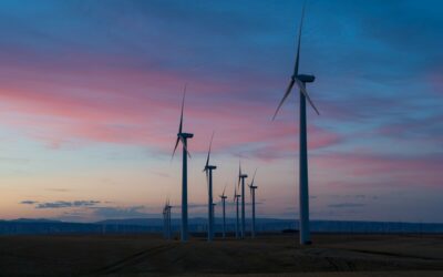
How the right location reduces construction and maintenance costs for wind farms
Beyond generating clean energy, the success of a wind project is also measured by its economic efficiency. In this...
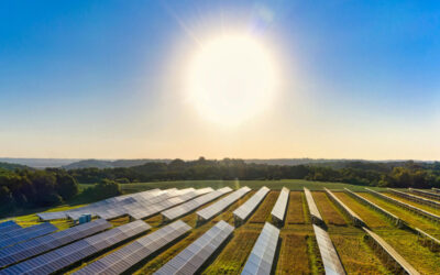
10 keys to site selection for solar parks
Choosing the right location for solar parks is one of the most strategic decisions in any solar energy project. The...
Investing in talent, driving innovation: Imageryst receives support from the Investigo program
At Imageryst, we believe that people and technology are the true engines of progress. Research and innovation are at...
Client Testimonials
What our users are saying
Now we can enrich our Location Intelligence solutions with real-time satellite, drone or lidar data and offer to our clients ad hoc solutions with reliable information using Imageryst API.
Thanks to Imageryst we are able to monitor the maintenance of vegetation close to the power lines and understand the accessibility of the area.
Segurança da Informação at Neoenergía.

With Imageryst, our data team efficiently analyzes land suitability for solar plant construction. The platform’s accurate data and seamless integration allow us to select optimal sites faster, saving time and resources on renewable energy projects.
Data Department of Iberdrola
Imageryst has been a game-changer for us in identifying the best locations for our solar panels. The platform’s easy-to-use tools and precise data have allowed us to strategically plan our installations, ensuring maximum efficiency and optimal energy generation.
Carlos Rodriguez Osorio
CEO at Solum