Top use case
Work Monitoring: stay on track
Follow construction progress through objective, non-invasive satellite surveillance
Reduce uncertainty, upgrade progress reporting
In any construction project, visibility is everything: progress, deviations, and risks can escalate quickly when teams rely on sporadic site visits and fragmented updates. Imageryst gives you a GIS-first, satellite-based view of your works—remotely, consistently, and at scale—so you always know what’s happening on the ground.
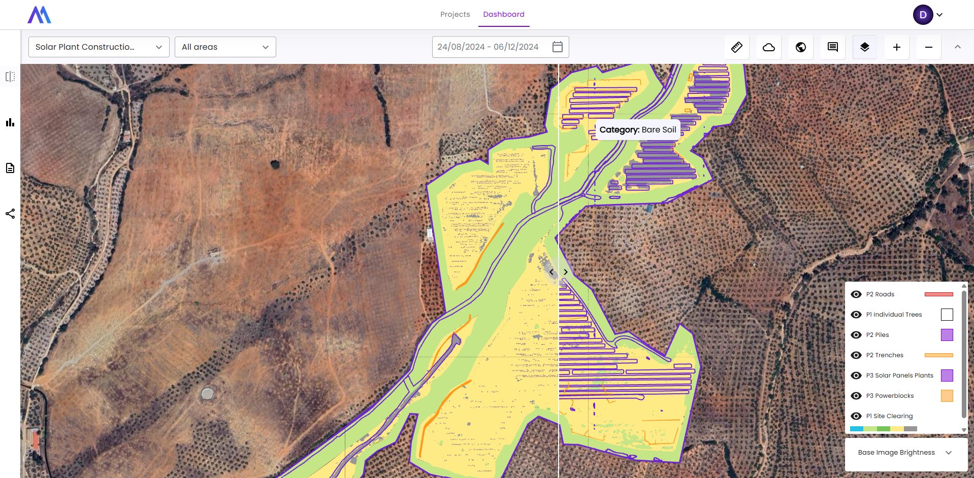
With frequent imagery updates and automated change detection, you can track earthworks and civil works progress, validate execution against the original plan, and spot unexpected changes early—before they become delays or claims. Outputs are delivered as ready-to-use GIS layers and dashboards that your technical and non-technical teams can share, compare over time, and integrate into existing workflows to keep decisions aligned and projects moving.
For technical or non-technical users
Collaborative tool
Seamlessly integrable
Automated reporting
Integrated progress & performance insights
Don’t just look at the site —measure what’s actually getting built. Combine fresh satellite imagery with GIS-ready progress KPIs (e.g., activity footprint, area completed vs. pending, change rates) to turn visual updates into objective, shareable reporting for stakeholders.
Time-series change detection
Stay ahead of deviations, not behind them. Compare imagery across dates to automatically highlight what changed—new earthworks, cleared areas, installed elements, or unexpected disturbances—so you can validate execution against plan and react early to risks that drive delays and claims.
GIS-first collaboration & delivery
Keep teams aligned with one source of truth. Export results as layers your engineers already use (GeoJSON/WMS/tiles) and standardize reporting across multiple sites—no manual screenshots, no scattered updates, just consistent deliverables that plug into existing workflows.
Remote audits & targeted site visits
Reduce unnecessary trips and focus fieldwork where it matters. Use remote monitoring to prioritize inspections, verify contractor updates, and document progress over time—improving traceability and decision-making while lowering oversight costs.
FAQ’s
Quick answers to common questions
How often does the satellite pass or what is the time interval (revisit/latency) between images?
It depends on the satellite. Standard or free satellites pass every 5 days, while paid satellites provide images almost daily.
What is the image precision/resolution?
How much does it cost to use Imageryst?
Imageryst is typically subscription-based, but we also provide ad-hoc solutions. Pricing varies based on the product (Land Analysis Core or Advanced, Work Monitoring, ad-hoc solutions…) and the image area (km²).
What types of companies does Imageryst work with?
We work with medium-sized enterprises (SMEs) and large companies in different sectors, such as energy, utilities and engineering. However, we are very keen on R&D and have no problem tailoring our solutions to your companies’ specific needs.