 Naturgy _ Work Monitoring Mock-Up. JUL-DEC. Area 002 (1)")
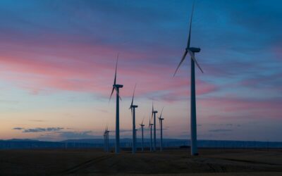
The transition towards a low-carbon economy depends heavily on the massive deployment of renewable energy. However, achieving energy decarbonization not only means generating clean electricity, but also reducing the carbon footprint in how we plan, build, and operate renewable infrastructure.
Satellite data plays a key role in optimizing each phase of the life cycle of solar or wind projects. Project developers, EPCs, IPPs, utilities, and technical consultancies around the world are already incorporating them to accelerate their renewable projects while minimizing the associated CO₂ emissions.
In fact, some studies indicate that the large-scale adoption of digital technologies such as satellite monitoring could contribute up to 20% of the emissions reduction needed in high-emission sectors like energy.
Below, we analyze how Imageryst’s technology helps reduce the carbon footprint during the construction, operation, and maintenance of renewable energy infrastructure.
Remote terrain analysis: efficient planning and fewer emissions from the start
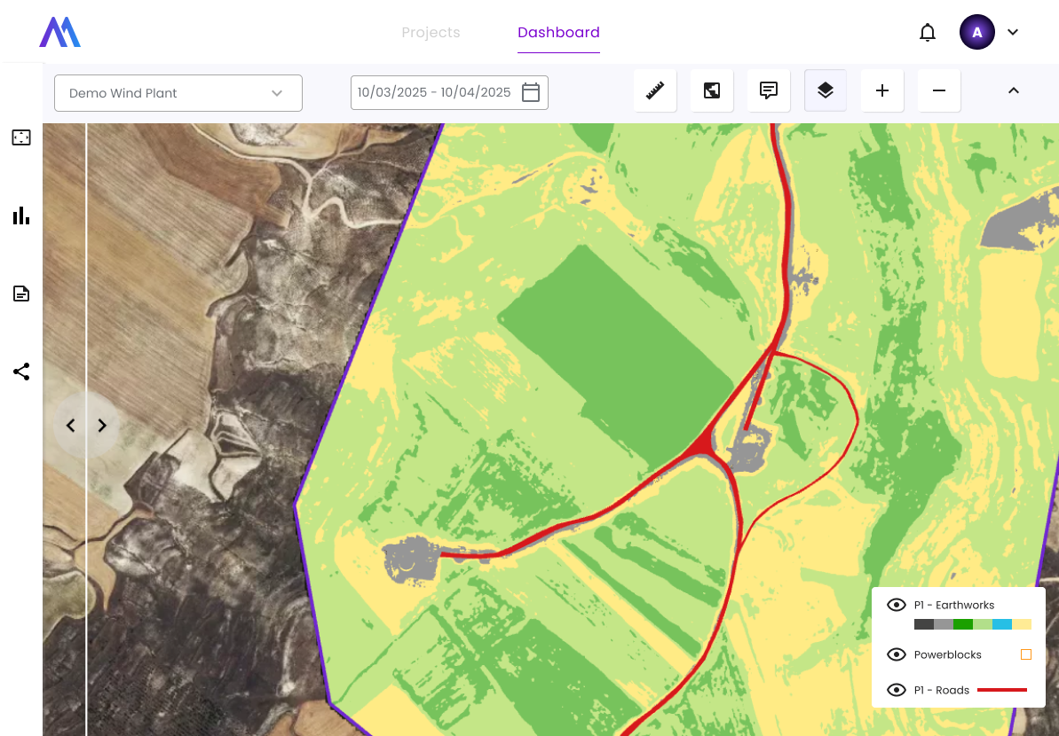
The pre-construction phase of a renewable project lays the foundation for its technical, economic, and environmental success. Imageryst enables remote analysis and prioritization of land to determine project feasibility before even setting foot on site.
Through up-to-date satellite imagery and geospatial data, the platform provides detailed analyses, identifies potential obstacles and constraints, and optimizes the preliminary design of the infrastructure.
This remote assessment capability brings several direct benefits for decarbonization:
Fewer initial trips
Development teams can evaluate dozens of potential sites from the office, minimizing field visits. This represents significant savings in vehicle travel or flights for preliminary inspections, avoiding the associated CO₂ emissions.
For example, a developer can quickly filter land with the best solar irradiance, electrical grid access, and no protected vegetation—without mobilizing personnel to each location.
Optimized design and civil works
By having digital terrain models (slopes, elevations, watersheds) from the early stages, it’s possible to design solar or wind farms that require less earth movement and fewer later adjustments.
An optimized design not only reduces construction costs and time but also involves less use of heavy machinery and construction materials, thereby lowering the project’s carbon footprint.
Sustainable site selection
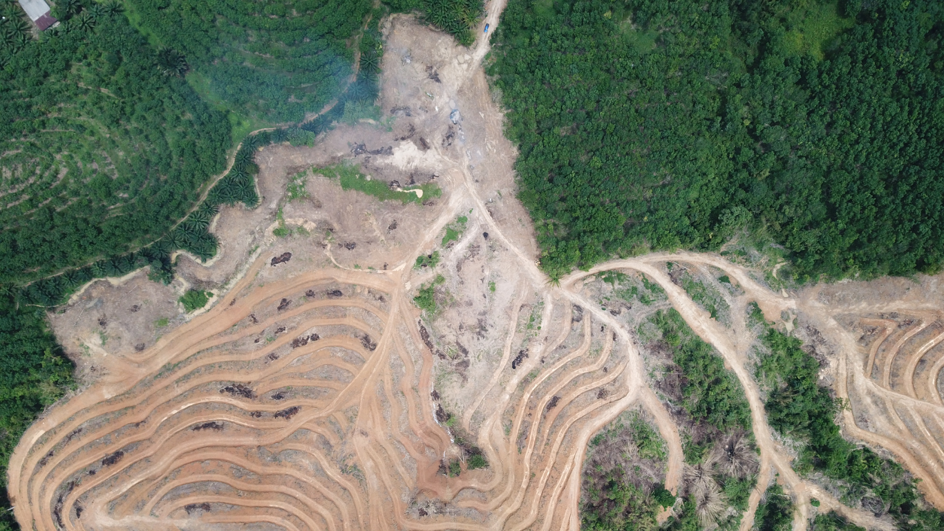
Imageryst helps identify environmental risks (such as flood zones, forest areas, or sensitive habitats) before deciding where to build. Avoiding deforestation or impact on valuable ecosystems means preventing significant carbon emissions.
Choosing already degraded or agricultural land for a photovoltaic plant—rather than clearing forest—is a decision enabled by satellite analysis, and one that has a direct positive impact on decarbonization.
In short, with a thorough remote analysis, developers make informed decisions from the outset. This minimizes unnecessary travel and leads to the selection of optimal sites that maximize renewable production and minimize emissions during construction and operation.
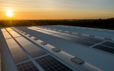
Construction monitoring: faster builds with a lower carbon footprint
During the construction phase of wind farms, solar plants, or other energy infrastructures, maintaining close control of progress is essential.
Imageryst offers continuous and remote monitoring of construction progress through frequent satellite images and other data sources, generating clear visual reports that allow for the detection of delays or issues before they seriously impact the project.
This remote visibility brings significant improvements in efficiency and sustainability:
Reduction of inspection trips
Project managers and engineering teams can check the construction status from anywhere, reducing the need for frequent physical visits to the construction site.
Fewer road trips to remote wind farms or fewer flights to supervise international projects translate into an immediate reduction in transportation emissions.
Early detection of planning deviations
Thanks to the comparative analysis of temporal images, Imageryst alerts users about schedule deviations, inactive machinery, or unauthorized changes on-site. By identifying these issues early, they can be quickly corrected, avoiding massive rework or prolonged downtime.
Every avoided delay means machinery operating efficiently only when necessary and fewer days of construction—factors that reduce the consumption of fossil fuels in equipment and vehicles.
Resource optimization and coordination
The platform facilitates sharing the construction status with all stakeholders through digital reports.
This improves logistical coordination (for example, scheduling just-in-time deliveries of materials) and avoids last-minute trips or urgent equipment shipments due to lack of visibility. Construction becomes more agile and with less waste, indirectly reducing the associated carbon footprint.
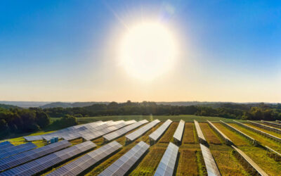
Predictive maintenance of assets
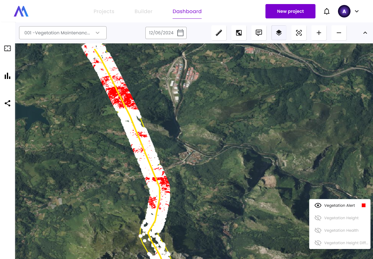
Once in operation, solar plants, wind turbines, power grids, and other assets require regular maintenance to function optimally. With Imageryst, infrastructure owners and operators have continuous remote monitoring of their assets, enabling them to prioritize maintenance tasks and anticipate failures before they occur.
Applying predictive maintenance based on satellite data and intelligent analysis has a clear impact on emissions reduction:
Fewer unnecessary interventions
Traditionally, many power companies conduct scheduled inspection rounds (e.g., visiting each solar plant monthly) regardless of whether there are problems.
With remote monitoring, these routines can be optimized: personnel are only dispatched when the data indicates a real anomaly (a damaged panel, a hot spot, vegetation growing near a cable, etc.).
By minimizing travel for maintenance teams, the fuel consumed by service vehicles is reduced, and so are emissions.
Anticipation of critical failures
The platform analyzes patterns in asset performance and even environmental features detected via satellite (for example, changes in the reflectivity of a solar panel that suggest excessive dirt, or terrain inclinations that could compromise the base of a wind turbine).
By anticipating a possible failure or degradation, preventive intervention can occur at the optimal time. This avoids emergency repairs that often require mobilizing heavy machinery or replacing large components with carbon-intensive processes.
Extension of asset lifespan
More accurate and proactive maintenance keeps equipment in better condition over the long term. Every additional year of life extracted from a wind turbine or solar inverter means a replacement doesn’t need to be manufactured and transported prematurely.
By extending the renewal cycles of equipment, the flow of materials and the energy invested in new manufacturing is reduced, thus contributing to a lower overall carbon footprint in the sector.
In addition, Imageryst incorporates information on terrain accessibility and optimal routes to reach each asset—especially useful in mountainous wind farms or power lines crossing remote areas.
This way, when an intervention is necessary, technicians can plan the most efficient route (in terms of time and fuel) and group tasks to avoid multiple separate trips. Operating renewable infrastructure intelligently ensures that clean energy generation is accompanied by equally clean and efficient operations.
Environmental impact assessment and EUDR compliance
The sustainability of an energy project is not measured solely in green megawatts produced, but also in its respect for the natural environment. Imageryst helps companies evaluate and monitor the environmental impact of their projects using historical satellite imagery and advanced geospatial analysis. This is crucial for complying with environmental regulations and maintaining the “green” credibility of investments.
Some of the ways in which this solution contributes to decarbonization and environmental responsibility include:
Deforestation control and land-use monitoring
Through the historical analysis of satellite imagery, Imageryst detects changes in land cover, allowing verification of whether an area was recently deforested.
This is especially relevant for compliance with the EUDR regulation (European Union Deforestation Regulation), which aims to prevent deforestation and reduce greenhouse gas emissions and will become mandatory by the end of 2025.
For example, a solar company exporting energy to the EU can prove—with satellite evidence—that its plant did not involve forest clearing after the regulatory cutoff date.
Preventing deforestation associated with new projects avoids releasing CO₂ stored in those ecosystems into the atmosphere, preserving the net positive contribution of renewables.
Ecological impact assessment and mitigation
The platform facilitates the monitoring of key environmental indicators during construction and operation. For example, it is possible to monitor vegetation regeneration in areas near a transmission line or the condition of a biological corridor around a wind farm.
By detecting deviations (such as soil erosion, sedimentation in rivers, or habitat fragmentation), companies can act early to mitigate damage, reforest affected areas, or adjust operations. This not only protects biodiversity but also keeps local carbon sinks functioning.
Transparency and regulatory compliance
Having an objective visual record of a project’s before-and-after state allows companies to produce robust sustainability reports and meet environmental audit requirements with ease.
In short… Imageryst offers the energy sector a 360° global view of its assets, resulting in projects that are more efficient, safer, and more respectful of the planet.
By adopting these solutions, we take meaningful steps toward real and lasting energy decarbonization, where every clean megawatt is accompanied by sustainable practices in its planning, construction, and operation.
Ready to join the change? You can request a demo of our solution here.